Conflicting Perspectives on Safety
|
By Bella Biwer
It is a fundamental need for humans to feel safe in their environments. Safety is an extremely broad term that is applicable to every aspect of our lives: where we go, what we do, what we eat, who we talk to, etc. In the context of Milwaukee’s urban neighborhoods, the issue of safety brings up discussions around crime, property damage, and environmental woes. Such discussions of safety are often impossible to resolve and difficult to analyze — they are wicked problem, which Jon Kolka describes as “a social or cultural problem that is difficult or impossible to solve for as many as four reasons: incomplete or contradictory knowledge, the number of people and opinions involved, the large economic burden, and the interconnected nature of these problems with other problems.” This project addresses the complexity of neighborhood safety by identifying the different forms of knowledge, discussions, and solutions around this issue.
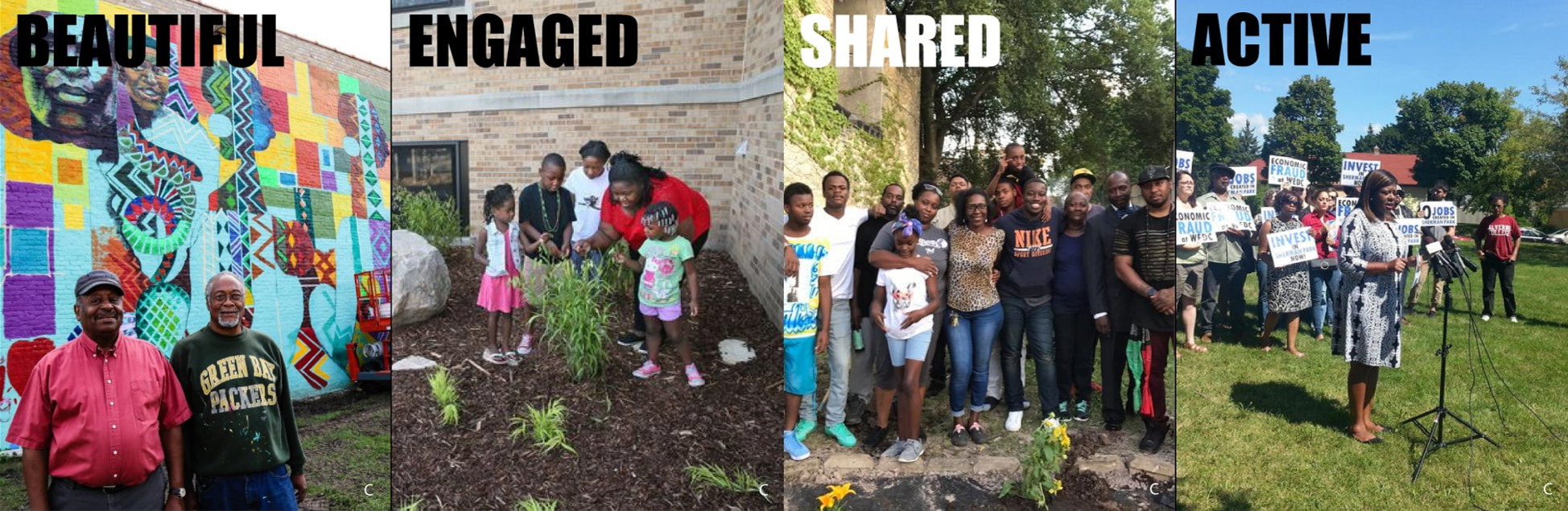
Background Sherman Park received a lot of attention in the Summer of 2016 when riots broke out over the police shooting of Sylville Smith. The media skewed this information to make it seem like the residents were the ones rioting. In fact, outsiders who were angry about the shooting came in and destroyed the property, and community residents gathered together the next morning and cleaned everything up. This negative media gave Sherman Park the reputation of being an unsafe and crime-riddled neighborhood. It also reinforced stereotypes about majority African-American communities and the north side of Milwaukee. While Sherman Park faces issues with unemployment, business, and education, the residents remain united in their dedication to their neighborhood. Methods I began by compiling scholarship on safety through the lenses of six different fields: criminology, architecture, urban planning, public health, geography, and social work and created an annotated bibliography. I used these terms and their keywords to create an overall taxonomy of the factors that influence safety and their related tools or solutions. Many of these terms were repeated between fields. I then narrowed down the most common and relevant keywords from all of this scholarship into the three broad terms CPTED, or Crime Prevention Through Environmental Design, walkability, and Defensible Space. I did research on these terms specifically and created a top-down taxonomy based on this scholarship for each. I then referenced the BLC Field School’s 2017 interviews taken in Sherman Park to find what terms residents used to talk about CPTED, walkability, and Defensible Space. I then integrated bottom-up taxonomies using these terms for each of the three keywords. Next, I made connections between the words that the scholarship used to talk about these aspects of safety and the words the residents used. In some cases, the exact same words were used. Most often, I made connections based off of looser similarities and relationships. This shows that even though the residents don’t use scholarly terms, they are certainly aware of their community and the issues in it. In fact, they are the experts. Using this method, I was able to identify terms residents used that were left out from the top-down taxonomies. In creating a comprehensive solution to safety that includes all viewpoints, these terms are where the real solutions lie. Results While I found that there has been a large improvement in safety literature because most of the language used to talk about safety in the grassroots interviews was also reference in top-town literature. However, there is still a disjuncture under the CPTED category, where food, education, and jobs were mentioned by community residents but not in literature. This shows that there is still misunderstanding about how grassroots organizers think about safety. Response Based on the knowledge of this disjuncture, Professor Arijit Sen and I began conducting community-led walks with residents of Sherman Park so that we could better understand their point of view. During these walks, residents share their knowledge of places in their community and point out significant and important places as well as things they would like to change. I also created quality cards using words that I had taken from my deep analysis of resident interviews, and community members used these to apply qualities to places in the neighborhood during the walks. After we had completed four community-led walks in Sherman Park, we had to determine how we were going to present our findings. This led me to the possibility of counter mapping as a powerful tool for continuing the discussion, and a logical one, too, since our findings were gathered sequentially in space. While mapping seems like a rather straightforward act of identifying important and influential places, we have to ask who is deciding what places are worth mapping? “What actors, resources, or social relations enabled a particular map to be produced? What relations does a particular map enable the reader to see? Or, otherwise stated, what relations of power and partiality does the map itself produce?” In reality, mapping is a tool used spread the mainstream narrative and either, “reinforce or contribute to power imbalances.” Therefore, it is also a means of further disinvesting in places that are not considered important or worth protecting. On the other hand, counter mapping, a term coined by Nancy Peluso, is the act of creating a map that ‘counters’ these normal cartographic conventions and power relations. In terms of environmental justice, social justice, and conservation, this act is a form of resistance in itself. It can be used to, “codify, to legitimate, and to promote the world views which are prevalent in different periods and places,” and cultures. Therefore, counter mapping is a means to quantify those perspectives that differ from the mainstream narrative, and, as a result, offers, “alternative ways of visualizing and inhabiting the world.” We decided to create an interactive counter map website that is accessible to the public. The resulting map of Sherman Park includes 33 vibrant homes, businesses, cultural spaces, and parks that community members told us about during the walks. The website is nearly complete, and includes photos, recordings of community members talking about the places, links to residents connected with the places, and links to relevant websites and articles. Since this site will also serve as a landing page for our Humanities Action Lab exhibit on Climate and Environmental Justice, I categorized each of the 33 places into their relevant justice types which will be evaluated further by other research students. These include immigration, food, transit, housing, safety and criminal, health, land, and other community assets. Through all of this, I have learned about the neighborhood from community members' points of view, and have seen their world through their eyes. These walks also helped me work towards an ethnographic methodology of data collection that allows me to engage grassroots voices in the understanding of architecture and place. The ultimate goal is that sharing valuable places in neighborhoods like Sherman Park with help change and expand the conversation around disinvested communities. |
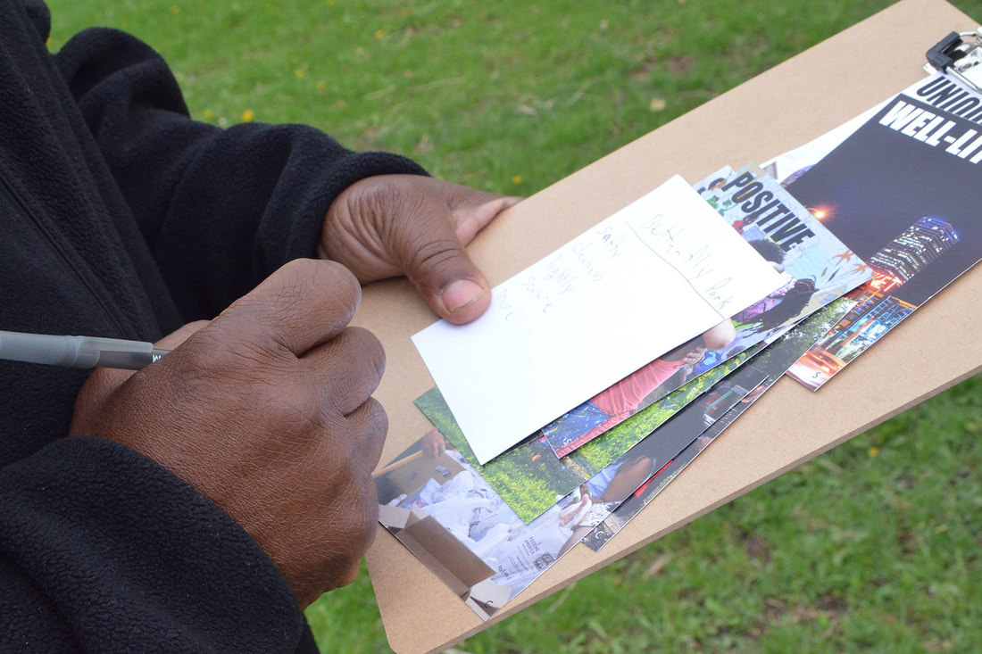
Quality Cards being used during a community-led walk
Quality Cards
|
Sources:
[1] Kolko, Jon. 2012. Wicked problems: problems worth solving: a handbook & a call to action. Stanford Social Innovation Review. Austin, TX: AC4D. https://ssir.org/articles/entry/wicked_problems_problems_worth_solving.
[2] Power of Maps : (Counter) Mapping for Conservation Hazen, Helen D.; Harris, Leila 2006 (page 101-102)
https://open.library.ubc.ca/cIRcle/collections/ubccommunityandpartnerspublicati/52387/items/1.0357973
[3] Harris, Leila M., and Helen D. Hazen. 2005. Power of Maps: (Counter) Mapping for Conservation. ACME 4(1): 99-130.
[4] Harley, J.Brian. 1989. Deconstructing the map. Cartographica 26, 1-20.
[5] Counter (Mapping) Actions: Mapping as Militant Research, Craig Dalton, Liz Mason-Deese (page 440) https://www.countercartographies.org/wp-content/files/Countermapping_Actions.pdf
